

| |
|
|
HIGH DEFINITION MAPS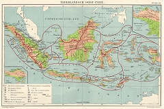 Map of Nederlandsch Indië, the Dutch East Indies from old school atlas. Scale 1:11,250,000. Published by Joh. Yekema, The Hague, probably around 1940. Size 4900x3250 pixels. Map of Nederlandsch Indië, the Dutch East Indies from old school atlas. Scale 1:11,250,000. Published by Joh. Yekema, The Hague, probably around 1940. Size 4900x3250 pixels.
|
| 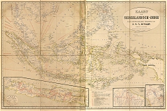 Detailed historical map of Nederlandsch Indië, the Dutch East Indies, by H. Ph. Th. Witkmap. Scale 1:5,000,000. Published by J.H. de Bussy, Amsterdam, 1893. Size 5416x3653 pixels. Detailed historical map of Nederlandsch Indië, the Dutch East Indies, by H. Ph. Th. Witkmap. Scale 1:5,000,000. Published by J.H. de Bussy, Amsterdam, 1893. Size 5416x3653 pixels.
|
| 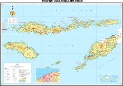 Map of Nusa Tenggara Timur. Excellent (and elsewhere hard to find) high definition map of Nusa Tenggara Timur, one of the main ikat producing areas. Scale 1:750,000. Produced by Badan Koordinasi Survei dan Pemetaan Nasional, Indonesia. Size 3742x2614 pixels. Map of Nusa Tenggara Timur. Excellent (and elsewhere hard to find) high definition map of Nusa Tenggara Timur, one of the main ikat producing areas. Scale 1:750,000. Produced by Badan Koordinasi Survei dan Pemetaan Nasional, Indonesia. Size 3742x2614 pixels. |
| 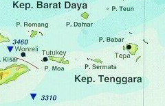 Map of The Moluccas. Not in high but medium resolution actually, but very clear. Produced by Landelijk Steunpunt Eudcatie Molukkers, Utrecht, 1998. Map of The Moluccas. Not in high but medium resolution actually, but very clear. Produced by Landelijk Steunpunt Eudcatie Molukkers, Utrecht, 1998.
|
| 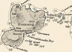 Map of Tanimbar and Sermata Islands in high resolution, prepared by US Hydrographic Institute for the US Navy. Scale 1:500,000. Revised 1959. Details accessible through zoom function. Map of Tanimbar and Sermata Islands in high resolution, prepared by US Hydrographic Institute for the US Navy. Scale 1:500,000. Revised 1959. Details accessible through zoom function.
|
| 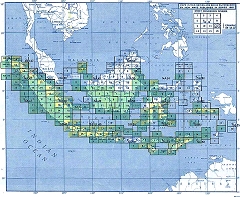 Clickable map of Indonesia, linking to fine grained topographical maps. Scale 1:250,000. Produced by the US Army Map Service, US Corps of Engineers. Probably the most detailed maps of the Indonesian archipelago in existence. Unfortunately not quite complete: Lombok, a small part of Bali, parts of Sulawesi, former penal colony Buru, most of the Tanimbar archipelago, Halmahera and some other islands in the Moluccas are missing, as is all of Serawak. To prevent disorientation keep in mind that some of the names are antiquated: the island of Lembata for instance is still called Lomblem as it was under the Dutch colonial regime. Clickable map of Indonesia, linking to fine grained topographical maps. Scale 1:250,000. Produced by the US Army Map Service, US Corps of Engineers. Probably the most detailed maps of the Indonesian archipelago in existence. Unfortunately not quite complete: Lombok, a small part of Bali, parts of Sulawesi, former penal colony Buru, most of the Tanimbar archipelago, Halmahera and some other islands in the Moluccas are missing, as is all of Serawak. To prevent disorientation keep in mind that some of the names are antiquated: the island of Lembata for instance is still called Lomblem as it was under the Dutch colonial regime.
|
| 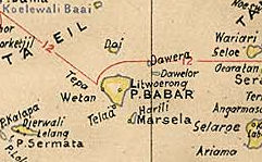 Many other detailed maps of the Indonesian archipelago, including US military maps and historical maps, can be found on the site of the University of Texas at Austin. Many other detailed maps of the Indonesian archipelago, including US military maps and historical maps, can be found on the site of the University of Texas at Austin.
|
|
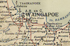 Historical colonial maps. As a result of the de facto closure of the Amsterdam Tropenmuseum as a scientific body, the world's largest collection of antique maps of the archipelago moved from the Koninklijk Instituut voor de Tropen to Rijksuniversiteit van Leiden. The positive effect is that the maps, many of them in very high resolution, are now all being georeferenced and matched with Google maps through 'crowd computing' - a hugely ambitious and worthy undertaking involving numerous volunteer geographers, many of them no doubt amateurs, but astute and dedicated. The sections that have been completed are accessible through a search engine and coupled with a display interface, as far as we can tell the legacy software, which is still very advanced and allows zooming in to astonishingly high definition. This is very valueable, as it allows us to see the art work up close. In the older maps, many of which were done in chromolithography, we see the individual strokes on the different stones: one for each colour and shade in the map, and done with a remarkable degree of precision. In the many sketch maps done by hand, in pen or pencil, some of them miracles of accuracy, we see the impressions of the drawing tools. Historical colonial maps. As a result of the de facto closure of the Amsterdam Tropenmuseum as a scientific body, the world's largest collection of antique maps of the archipelago moved from the Koninklijk Instituut voor de Tropen to Rijksuniversiteit van Leiden. The positive effect is that the maps, many of them in very high resolution, are now all being georeferenced and matched with Google maps through 'crowd computing' - a hugely ambitious and worthy undertaking involving numerous volunteer geographers, many of them no doubt amateurs, but astute and dedicated. The sections that have been completed are accessible through a search engine and coupled with a display interface, as far as we can tell the legacy software, which is still very advanced and allows zooming in to astonishingly high definition. This is very valueable, as it allows us to see the art work up close. In the older maps, many of which were done in chromolithography, we see the individual strokes on the different stones: one for each colour and shade in the map, and done with a remarkable degree of precision. In the many sketch maps done by hand, in pen or pencil, some of them miracles of accuracy, we see the impressions of the drawing tools.
©Peter ten Hoopen, 2024. The contents of this website are provided for personal, educational, non-commercial use only. No part of this website may be reproduced in any form without explicit permission of the copyright holder. |